SmartMap

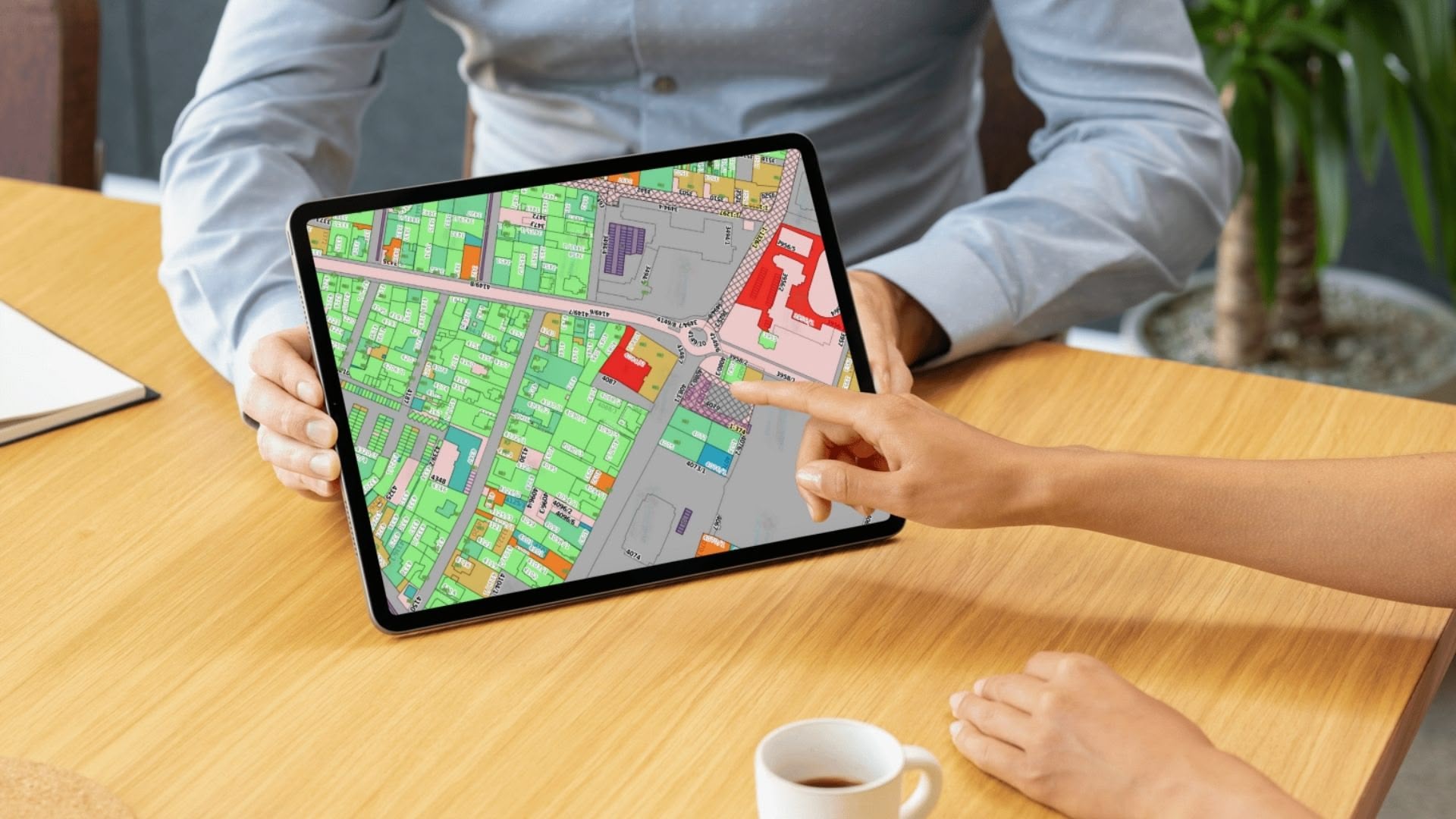
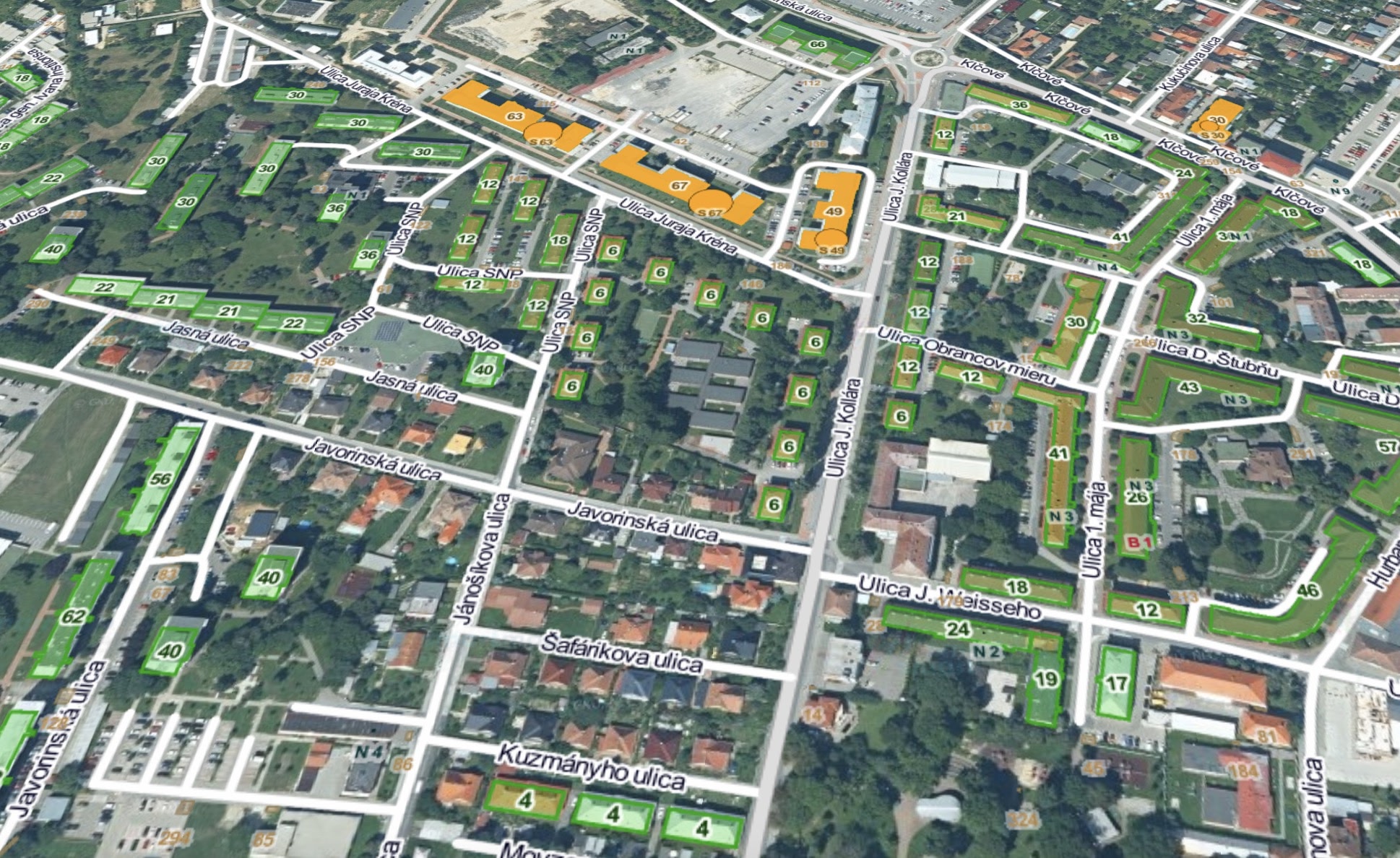
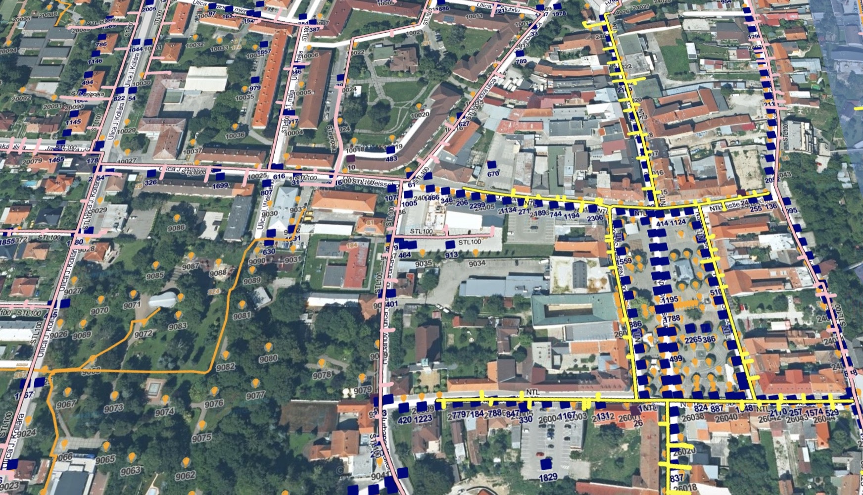
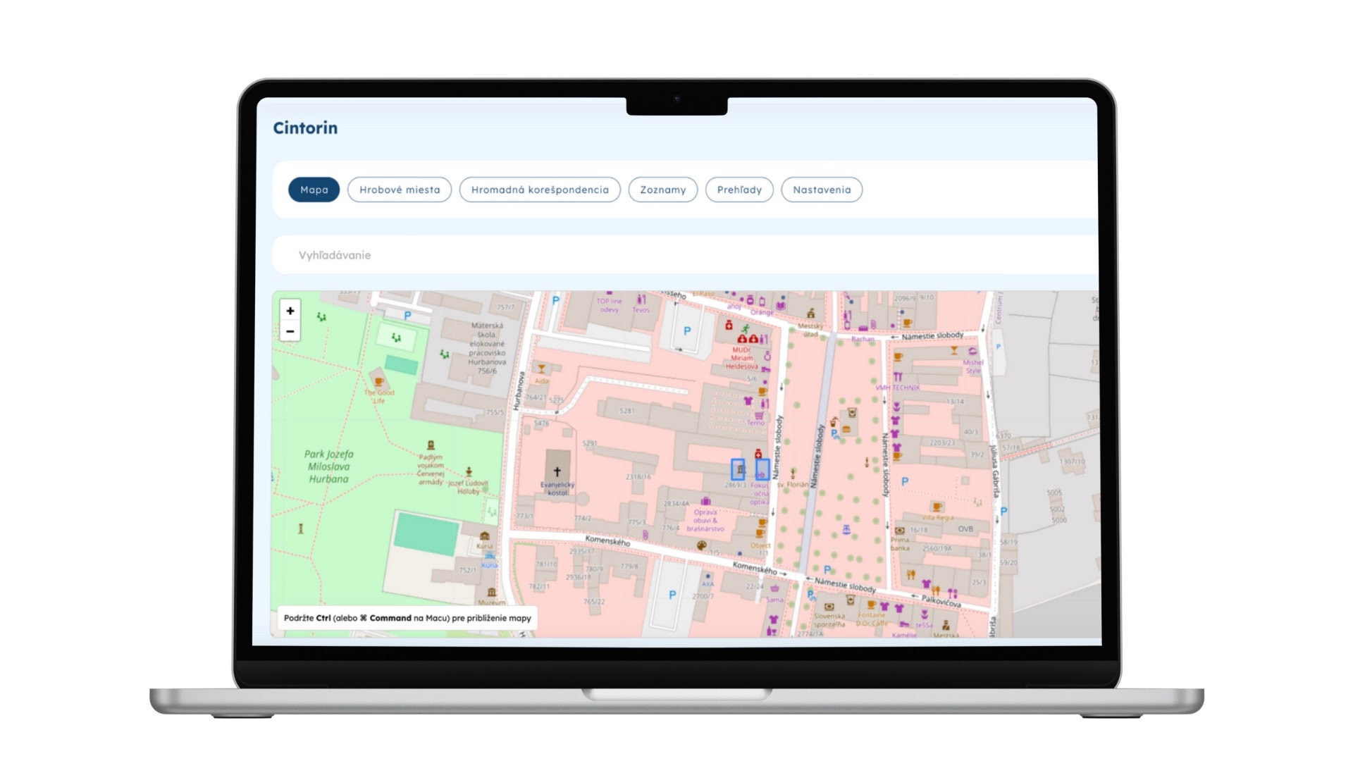
It brings a progressive way of displaying and evaluating local government data in space. SmartMap is not just a map visualization tool - it is a sophisticated technology platform that integrates map, agenda and process functions into one comprehensive solution.

The deployment of the system is always preceded by a comprehensive analysis and consolidation of the data so that subsequent analyses are based on factual information. In addition, SmartMap has a modular structure, which allows its environment to be individually adjusted according to the needs of the municipality.

SmartMap is a revolutionary tool designed to improve and simplify processes in local governments.

This system has been developed over many years and is continuously improved to take into account the needs of the practice.

Modern map service for efficient work with spatial data.

Throughout the process, we work closely with municipal representatives to understand their exact requirements and create a bespoke solution.

Main functions

Interactive maps and data visualisation

  • View detailed maps with the ability to layer different types of information.
  • Colour and thematic layers for better data clarity.
  • Possibility to activate and deactivate individual layers as required.

Data search and analysis

  • Search for plots and buildings - information on ownership, size and purpose of properties.
  • Analysis of land use plans - overview of regulations, restrictions and land use options.
  • Assessment of accessibility to services - analysis of distances to important points (schools, shops, hospitals).

Layers with information data

  • Infrastructure - roads, sidewalks, cycle paths, parking areas.
  • Public services - garbage bins, collection yards, lighting, camera systems.
  • Traffic information - closures, traffic restrictions, public transport availability.
  • Environment - green spaces, parks, air quality, noise maps.

IoT device integration

  • Weather stations, cameras, sensors.
  • Parking and light points.
  • Metering equipment (water, electricity).

Comprehensive data integration

  • Agenda and registration data: addresses, inhabitants, taxes.
  • Documents and photo documentation: integration of documentary documentation.
  • In principle, it is possible to integrate any database according to the customer's needs.

Support for administration and communication

  • The possibility of sharing map data between authorities, companies and citizens.
  • Notification of changes in the territory - planned construction, traffic restrictions.

Why SmartMap?

SmartMap is a modern tool that provides an effective solution for anyone who needs to work with accurate and up-to-date data. It enables fast and informed decision making by providing detailed and reliable information in a clear format. Its intuitive user interface makes it easy to use and requires no special training or technical knowledge.

One of the key benefits of SmartMap is to improve transparency in public administration. It enables effective monitoring and analysis of data, helping to optimise processes and improve management efficiency. This leads to better use of resources and faster decision-making at all levels.

In addition, SmartMap is available online no installation required, which means you can use it anytime, anywhere. This flexibility ensures that important information is always at hand, no matter where you are. With the combination of accurate data, easy accessibility and process optimisation SmartMap becomes an invaluable tool for organisations and individuals who want to work efficiently and transparently.